Marcella Club Terrain Model
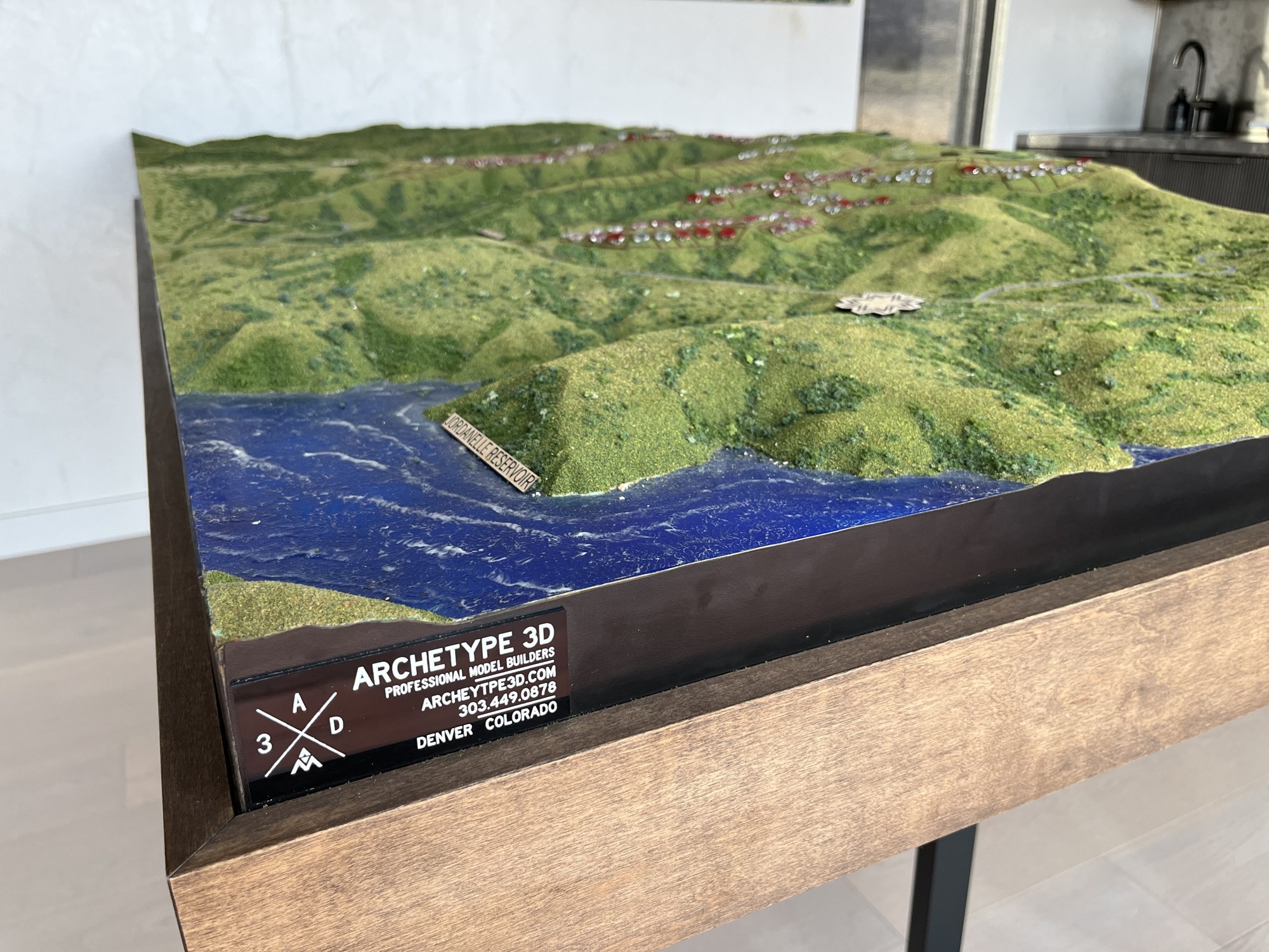
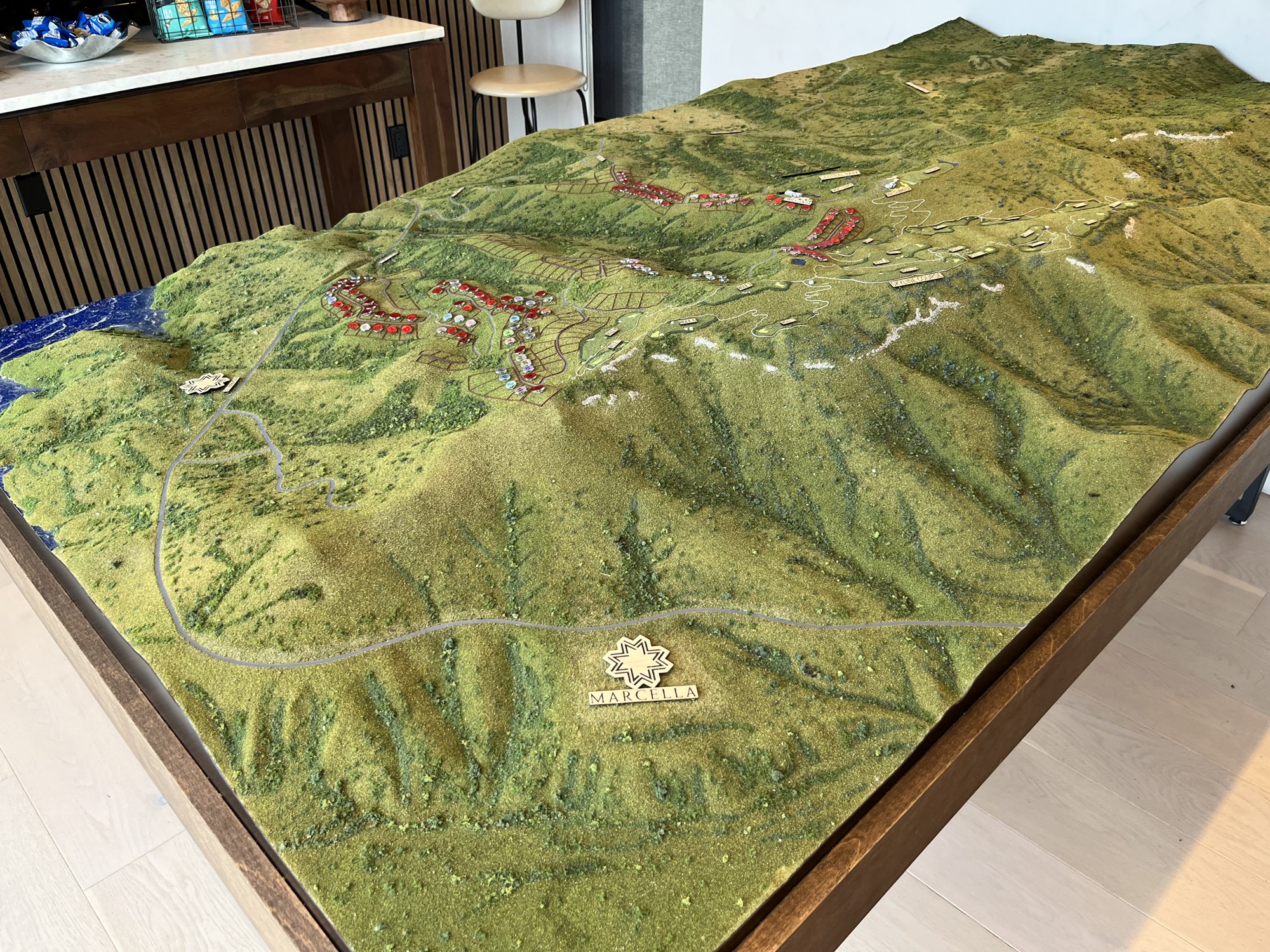
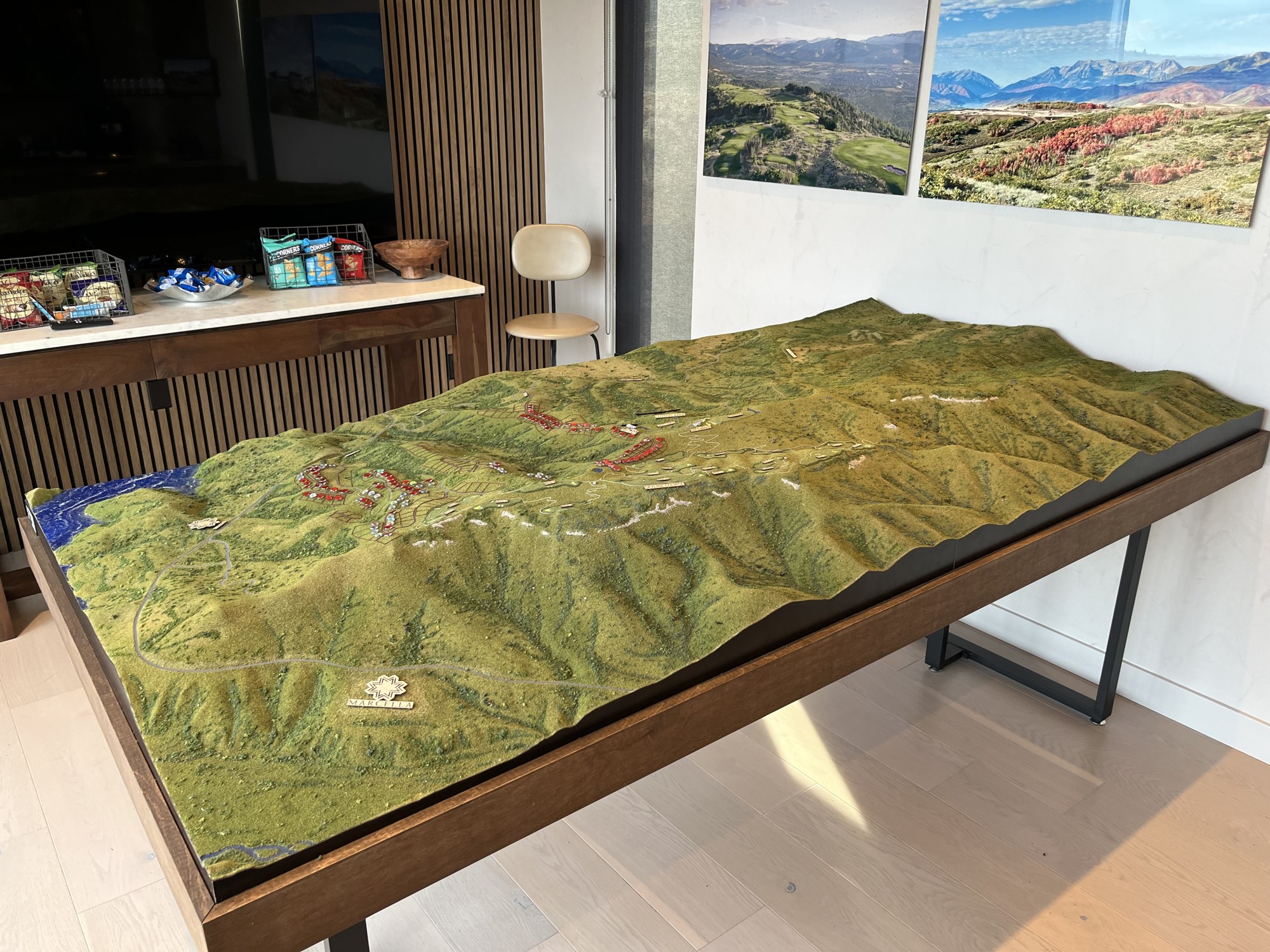
Our physical model of Marcella Club brings the proposed development and its Utah landscape together, showing the golf course, roads, lot lines and amenities across the terrain.
Seeing the development in its landscape
Seeing the development in its landscape The project brought the landforms, roads, paths, lot lines and amenities into a shared view. Elevation information shaped the terrain, with the landscape finished as a spring and early summer scene. The model was planned in north and south sections so the current design and areas for future development could be considered together.
More real estate development models- Project type
- Real estate / topography model
- Purpose
- Our physical model of Marcella Club brings the proposed development and its Utah landscape together, showing the golf course, roads, lot lines and amenities across the terrain
- Features
- Our physical model of Marcella Club brings the proposed development and its Utah landscape together, showing the golf course, roads, lot lines and amenities across the terrain
More views of the model
Showing the golf course with future development areas
The Marcella Club model combines the golf course with roads, lot lines and amenities. North and south sections distinguish the current design from future development areas, allowing a viewer to understand the club as both a course and a broader real estate plan. This is the type of golf-course model that belongs within topography and development work: it uses terrain and site context to explain how recreation and planned homes relate.
Other projects
Planning a similar model?
Explore related model services and our scale model cost guide.