
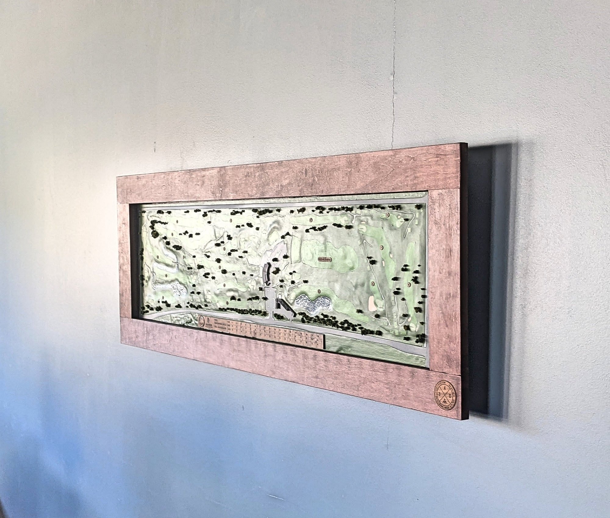
City Park Golf Course
We used drone-collected elevation data to build a physical replica of Denver’s City Park golf course, bringing its contours and course layout into the same view.
City Park Golf Course
City Park Golf Course We combined that terrain with satellite imagery and course information. The finished piece shows the course as a landscape, with its contours and layout visible together.
More topography & site models- Project type
- Topography model
- Model size
- 18 × 48 in
- Scale
- 1:500
- Purpose
- We used drone-collected elevation data to build a physical replica of Denver’s City Park golf course…
- Features
- We used drone-collected elevation data to build a physical replica of Denver’s City Park golf course…
Combining course contours with the playing route
For City Park Golf Course, drone-collected elevation data was combined with satellite imagery and course information to show both the land and the layout. The 18 by 48 inch model at 1:500 lets viewers trace the course across the park and understand how the holes sit within the surrounding terrain. This is a topographic site model centered on a golf course, useful when the landscape and route need to be seen at the same time.
The combination of elevation information and course imagery helps the model communicate both the land and how the course is arranged on it. Its scale allows a viewer to trace the layout while keeping the surrounding park in view.
Other projects
Plan your model
See our scale model cost guide.